Swiss Hike - Southeast Crossing

Distance:

~15 days, 230 km

Altitude:

Between 200 and 2830m,
up ~14 0000m, down ~15 000m

Start:

Gargellen, Austria

Finish:

Locarno, Switzerland

Difficulty:

Undetermined, probably quite tough

Strenuous:

Undetermined, but some days require lots of climbing

Greetings:

Austrian, Swiss German, Italian

Summary

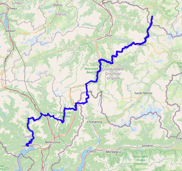
This route isn't really a thing yet, but looking at the map of the already existing long-distance routes across the country, it's easy to see a pattern. There's the Jura Höhenweg (in the north of the country, running kind of south-westish), and the number 3 Panoramaweg (a bit further south, also running kind of south-westish), and the Alpine Pass Route (further south again, similar direction), and the number 6 (similar direction) as well. But there seems to be a gap in the southeast, where a route could pass through some spectacular areas of Graubünden and Ticino running in a similar direction. So that could be a thing too.

I haven't done this route yet, and obviously it isn't an existing national route with clear signposting, but when opportunity arises I'll see if I can explore the way. Many stretches of this route are covered by regional routes already so it should be easy to navigate.

Most of the route is in Switzerland, of course, but it starts in Austria and diverts briefly into Italy. And there should be some interesting contrasts in scenery, landscapes and of course cuisine!

Getting there and back

There are many access points along the way, making it easy to split up into manageable sections. It starts in Gargellen, Austria, which can be reached by bus from Schruns and St Gallenkirch. The end point is Locarno, Switzerland, which has good train connections via Bellinzona. And inbetween there are countless bus stops and train stations, and there should be plentiful accommodation options too.

Hike map

There isn't a full coordinate track available yet, but the picture on the right shows is what the route should look like:

The walk

Obviously you can choose to split this up differently, but here is one proposal of the stages:

  1. From Gargellen following the #30 "Via Valtellina" southwards over the Schlappina Joch down through Schlappin to Klosters Schlappin (Stage2), finishing either at Klosters Dorf or Klosters Platz
  2. Continuing along the same #30 from Klosters to Davos (Stage3)
  3. Following the #54 "Mittelbünden-Panoramaweg" from Davos to Arosa (Stage2)
  4. Continuing on the #54 from Arosa to Lenzerheide (Stage1, or Arosa to Lenzerheide) — this contains the highest crossing of the route on the Parpaner Rothorn.
  5. From Lenzerheide south on the #64 "Via Sett" to Lantsch/Lenz, then west on the #33 "Via Albula/Bernina" to Thusis.
  6. From Thusis south on the #50 "ViaSpluga" to Andeer.
  7. Continuing on the #50 "ViaSpluga" to Splügen.
  8. Continuing on the #50 "ViaSpluga" across the border to Isola, Italy.
  9. West over the ridge back into Switzerland, and down to Mesocco (Via Alpina Red 83)
  10. West into the Val Calanca and south to Selma (Via Alpina Red 84)
  11. West over the next ridge to Biasca (Via Alpina Red 85 and 86)
  12. Long climb West up to the Capanna Efra (Via Alpina Red 87)
  13. Down to the Valle Verzasca through Gerra to Lavertezzo on the #74 Sentiero Verzasca
  14. Continuing on the #74 Sentiero Verzasca to Mergoscia - see also Valle Verzasca
  15. Continuing on the #74 Sentiero Verzasca to Locarno and a well-deserved dip of the feet in Lago Maggiore

Contour

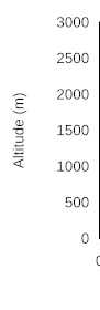
This route, like the others which cross Switzerland, is not exactly flat, as can be seen from the profiles:

contour of stage1
contour of stage2
contour of stage3
contour of stage4
contour of stage5
contour of stage6
contour of stage7
contour of stage8
contour of stage9
contour of stage10
contour of stage11
contour of stage12
contour of stage13
contour of stage14
contour of stage15

More info

Will follow as the opportunity arises to research the route.

Getting Started // Equipment // Swiss Day Hikes // Swiss Multi-Day Hikes // Alpine Pass Route // Jura Ridgeway // Southeast Crossing // Swiss Hike Map // Germany // Nepal treks // Madeira // Britain